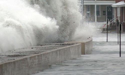
Sea levels are rising as global warming heats up the planet. Many military bases along the US East Coast and Gulf of Mexico are at risk of permanently losing land to the ocean in the decades ahead.
As the seas rise, high tides will reach farther inland. Tidal flooding will become more frequent and extensive. When hurricanes strike, deeper and more extensive storm surge flooding will occur.
The US Armed Forces depend on safe and functional bases to protect the national security of our country. We must prepare for the growing exposure of our military bases to sea level rise.
Military bases at risk
18 military installations are included in this analysis. Each location's changing exposure to flooding is projected through the end of the century:
- Maine: Portsmouth Naval Shipyard
- New Jersey: US Coast Guard Station Sandy Hook
- Maryland: US Naval Academy
- Washington, DC: Joint Base Anacostia-Bolling and Washington Navy Yard
- Virginia: Joint Base Langley-Eustis | Naval Air Station Oceana Dam Neck Annex | Naval Station Norfolk
- North Carolina: Marine Corps Base Camp Lejeune
- South Carolina: Marine Corps Recruit Depot Parris Island and Marine Corps Air Station Beaufort
- Georgia: Hunter Army Airfield | Naval Submarine Base Kings Bay
- Florida: Naval Air Station Key West | Naval Station Mayport | Eglin Air Force Base
Key findings
The military is at risk of losing land where vital infrastructure, training and testing grounds, and housing for thousands of its personnel currently exist.
- By 2050, most of the installations in this analysis will see more than 10 times the number of floods they experience today.
- By 2070, half of the sites could experience 520 or more flood events annually—the equivalent of more than one flood daily.
- By 2100, eight bases are at risk of losing 25 percent to 50 percent or more of their land to rising seas.
- Four installations—Naval Air Station Key West, Joint Base Langley-Eustis, Dam Neck Annex, and Parris Island—are at risk of losing between 75 and 95 percent of their land by the end of this century.
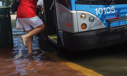
- Flooding won’t be confined to the bases. Many surrounding communities will also face growing exposure to rising seas.
About this analysis
Each base's exposure is calculated based on the National Climate Assessment’s midrange or “intermediate-high” sea level rise scenario (referred to in this analysis as “intermediate”), which projects a global average increase of 3.7 feet above 2012 levels, by 2100; and a “highest” scenario based on a more rapid rate of increase, which projects a global average increase of 6.3 feet.
The highest scenario is especially useful when making decisions with a low tolerance for risk. Moreover, recent studies suggest that ice sheet loss is accelerating and that future dynamics and instability could contribute significantly to sea level rise this century.
This analysis includes an executive summary; key findings; and fact sheets for each location, which can be downloaded via the links above. You can also download all of the materials as a single PDF. For more, please see the detailed methodology and key caveats for this analysis.
In this report
Causes of Sea Level Rise: What the Science Tells Us
Encroaching Tides
Downloads
Related resources

Saving Endangered Species: Turtle by Turtle
The Case Against ExxonMobil, Chevron, and other Fossil Fuel Companies

Is Capturing and Storing CO2 Emissions a Viable Climate Solution?